Using maps
Reference: NRO 0324/G/5 Hexham, DT 400/M Rothbury, ZHE 5/11 Alnwick
CONTEXT
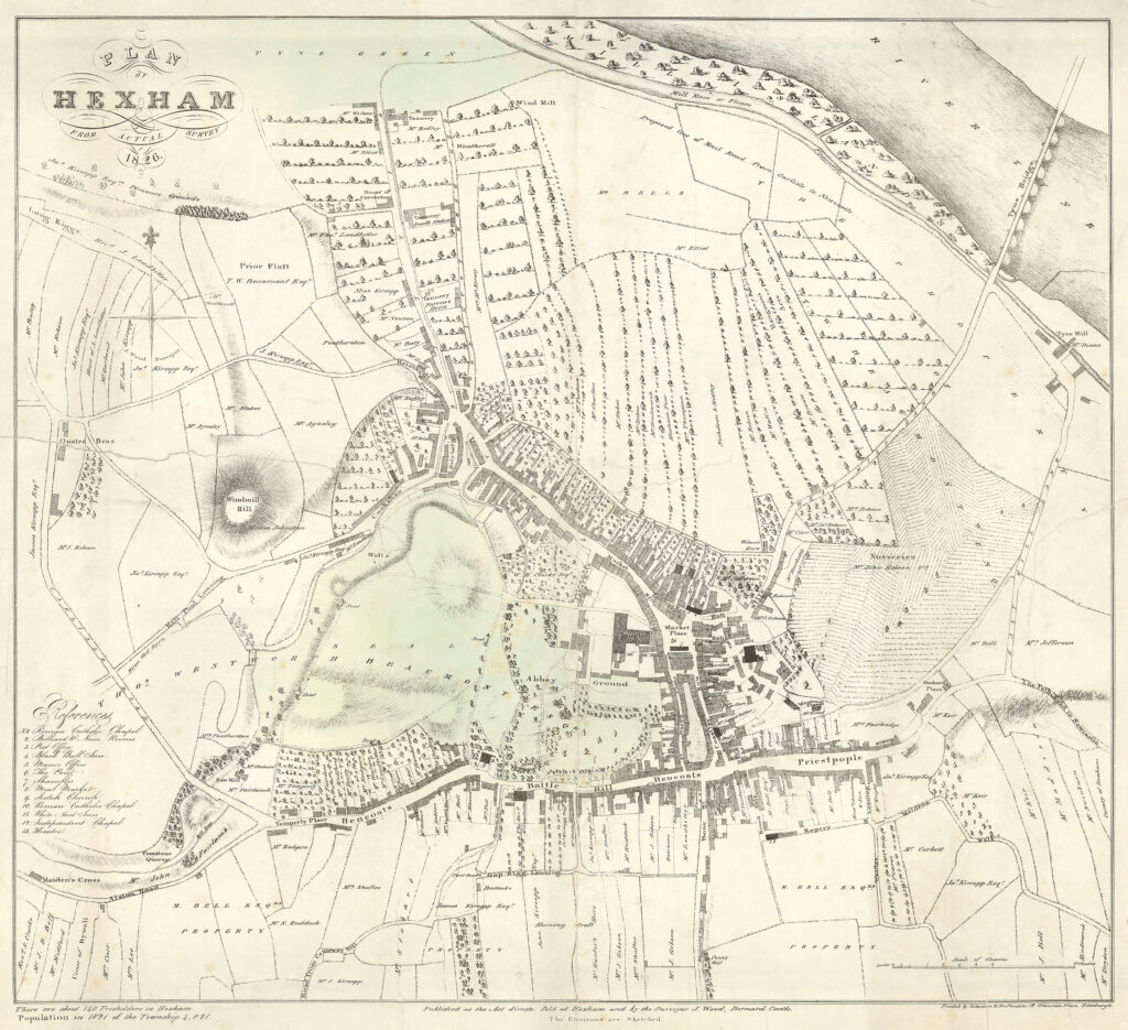
John Wood’s town map of Hexham, 1827
John Wood was a Scottish cartographer who produced over 150 maps of towns in Scotland, England and Wales. Wood often surveyed his own maps and created these attractive and accurate town plans.
The names of owners/occupiers were often recorded on plots of land.
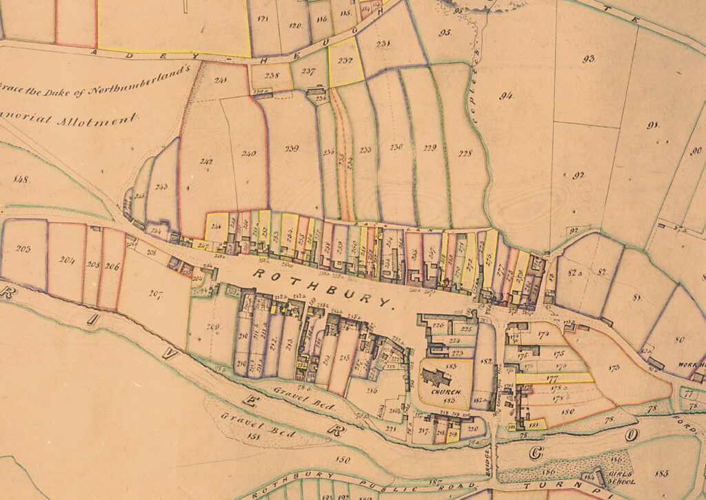
Rothbury parish tithe map, 1848
The 1836 Tithe Commutation Act replaced the ancient system of payment in kind to the church (giving 1/10th of everything that a farmer grew or produced) with a money payment based on the rental value of property. In order to calculate the new money payment, detailed maps were drawn up. Each map also has an “apportionment” which is a list of the owners/occupiers of the land.
https://www.nationalarchives.gov.uk/help-with-your-research/research-guides/tithes/
https://www.whodoyouthinkyouaremagazine.com/tutorials/what-are-tithe-maps/
https://northumberlandarchives.com/docs/HISTORIC%20MAPS%20AND%20PLANS.pdf
John Wood’s town map of Alnwick
John Wood was a Scottish cartographer who produced over 150 maps of towns in Scotland, England and Wales. Wood often surveyed his own maps and created these attractive and accurate town plans.
The names of owners/occupiers were often recorded on plots of land.
GIVE IT A GO
- Think about what you know about Hexham, Alnwick and Rothbury.
Can you say anything about their relative sizes/populations? Do you know where they are? Have they got anything in common?
Look closely at the maps of Hexham, Alnwick and Rothbury.
Can you see any similarities in the way that they are set out? Concentrate on the boundaries of properties along the roads.Have a look at these places on a current map, such as Google Maps. Are the patterns you can see on the nineteenth-century maps still visible?
Answer goes here.
Answer 1
Answer 2
Answer 3
OTHER ONLINE RESOURCES
Burgages
Burgage Plots website, fantastic source of information about all aspects of burgage plots: www.burgageplots.info
Burgage Plots website, page with links to other online sources: https://www.burgageplots.info/links
Amble and District Local History website, page about Warkworth (from JC Hodgson A History of Northumberland 1899): https://www.fusilier.co.uk/warkworth_northumberland/warkworth.htm
Morpeth Conservation Area Review website, page about town’s heritage: https://morpeth-conservation-area-review-luc.hub.arcgis.com/
Royal Berkshire History for kids website, page about burgage plots (includes diagram): http://www.berkshirehistory.com/kids/burgage_plots.html
Marian L. Wilson Plan analysis of the medieval boroughs of Northumberland PhD thesis, Edinburgh, 1989 (PDF download): https://era.ed.ac.uk/bitstream/handle/1842/6884/294040.pdf?sequence=1
Manorial records
Cumbrian Manorial Records website from Lancaster University (includes glossary of manorial terms):
https://www.lancaster.ac.uk/fass/projects/manorialrecords/manors/whatis.htm
Digital Humanities Institute website (Shffield University), pages about Conisbrough Manor (includes glossary of manorial terms): https://www.dhi.ac.uk/conisbrough/index.html
Manorial Documents Register database from The National Archives: https://discovery.nationalarchives.gov.uk/manor-search
Hexham
Hexham Local History Society website, page with gallery of leather working images: https://www.hexhamhistorian.org/historic-hexham/photograph-archive/photo-archive-choices/hexham-choices/industry-and-transport-gallery/leather-gallery/


