What is a burgage?
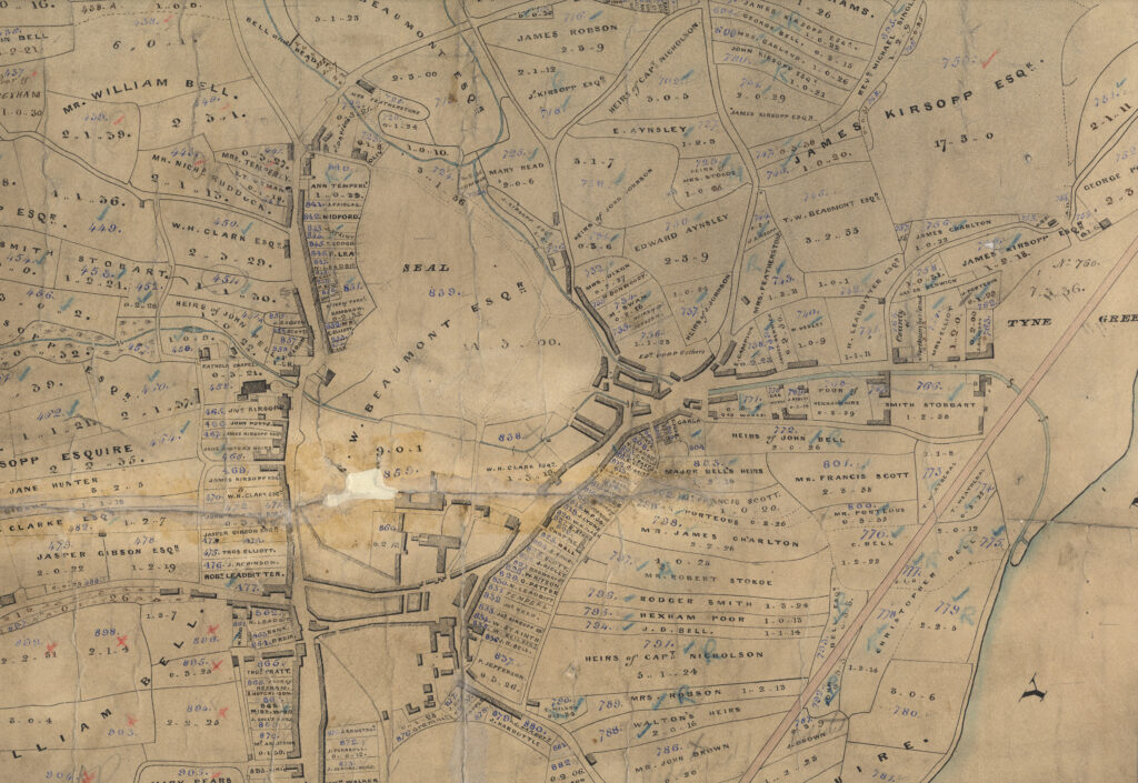
Reference: DT 241/L Hexham – Tithe map, 1844
CONTEXT
A burgage is a long thin strip of land. The short end of the strip faces onto a road. A building, with a shop on the ground floor and living quarters above, was built at the road end.
Behind the shop would be a “fold and garth”. A “fold” is an area for keep animals and a “garth” is another name for a garden. Food stuffs were often grown in the garths.
There might also have been a “backhouse” on the burgage plot. As the name suggests, this was another building behind the first building that faced onto the road. This might have been used for storage or as a workshop.
The ratio of the width to length on a burgage plot is often about 1:6.
TR Slater The Analysis of Burgage Patterns in Medieval Towns Area, Vol. 13, No. 3 (1981) pp. 211
Burgages are the basic “cells” in any analysis of medieval town plans. They are characteristically long and narrow and are arranged in series along the streets. Once laid out, the boundaries of burgages were often subject to division, both lengthways and, if there was access to the rear, widthways, but such plot division did not normally remove or alter earlier boundaries.

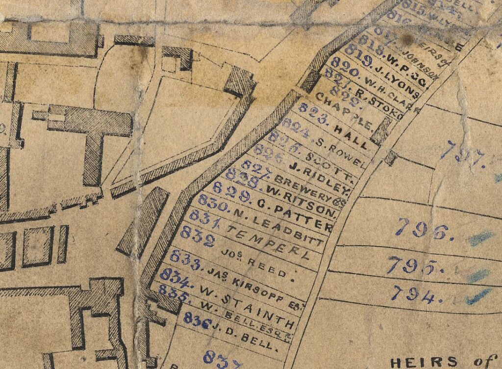
This detail shows a row of burgage plots by the marketplace in Hexham. The continuous shaded block that follows the line of the road represents the structures on the burgage plots. Like with a terrace of houses, these buildings shared boundary walls on either side. Most would have been shops.

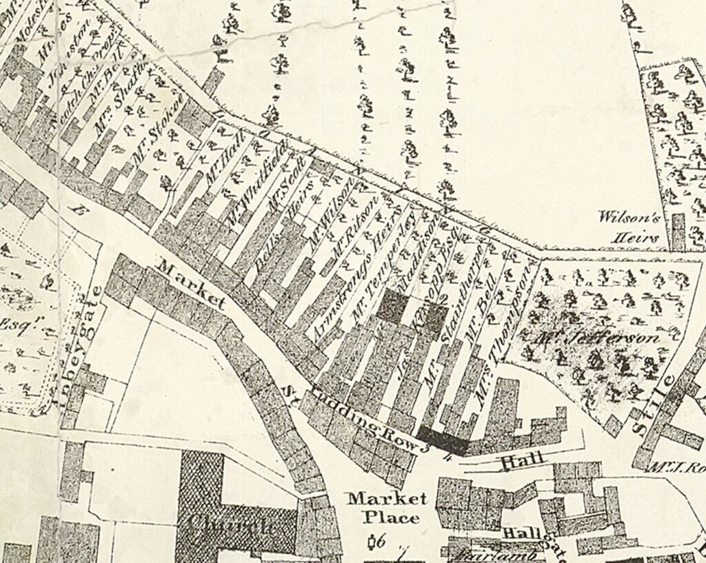
On this slightly earlier map, you can see a similar part of the town. On this version you can see how the owners of the burgage plots tended to add on to their buildings behind the frontage. On some of the plots there are “back houses” or separate structures built behind the initial structure. To gain access to the back of the burgage plot, owner sometimes built an arch or passageway that would lead to the buildings behind the frontage. Some of these can still be found in Hexham and other towns with burgage plots. Have a look out for them!
The Woods map also shows trees growing on the burgage plots in the “fold and garth” or animal pen and garden.
GIVE IT A GO
- Compare the two maps without looking at any information about them.
- Where in Northumberland do you think the map is showing?
- Which of the two maps do you think is oldest, and why?
- What years do you think the two maps are from?
- Make note of the similarities and differences between the two maps.
- Use Google Maps to look at the present day version of this location. How has it changed?
- Use the information within this module to make note of any key features of burgages that you can identify within these maps.
OTHER ONLINE RESOURCES
Burgages
Burgage Plots website, fantastic source of information about all aspects of burgage plots: www.burgageplots.info
Burgage Plots website, page with links to other online sources: https://www.burgageplots.info/links
Amble and District Local History website, page about Warkworth (from JC Hodgson A History of Northumberland 1899): https://www.fusilier.co.uk/warkworth_northumberland/warkworth.htm
Morpeth Conservation Area Review website, page about town’s heritage: https://morpeth-conservation-area-review-luc.hub.arcgis.com/
Royal Berkshire History for kids website, page about burgage plots (includes diagram): http://www.berkshirehistory.com/kids/burgage_plots.html
Marian L. Wilson Plan analysis of the medieval boroughs of Northumberland PhD thesis, Edinburgh, 1989 (PDF download): https://era.ed.ac.uk/bitstream/handle/1842/6884/294040.pdf?sequence=1
Manorial records
Cumbrian Manorial Records website from Lancaster University (includes glossary of manorial terms):
https://www.lancaster.ac.uk/fass/projects/manorialrecords/manors/whatis.htm
Digital Humanities Institute website (Shffield University), pages about Conisbrough Manor (includes glossary of manorial terms): https://www.dhi.ac.uk/conisbrough/index.html
Manorial Documents Register database from The National Archives: https://discovery.nationalarchives.gov.uk/manor-search
Hexham
Hexham Local History Society website, page with gallery of leather working images: https://www.hexhamhistorian.org/historic-hexham/photograph-archive/photo-archive-choices/hexham-choices/industry-and-transport-gallery/leather-gallery/


