Maps and Plans
Maps and plans are a useful starting point for research. They can help place a property in time, may indicate a change in the form of a building and are generally relatively easy to access and understand.
Ordnance Survey Maps
Ordnance Survey maps provide a good starting point. They are the main series of British mapping. The Ordnance Survey Board was established in 1791 initially to map the south coast of England after fears of a French invasion arose. The Board subsequently went on to survey all of Great Britain issuing series of maps at varying dates and in various scales.
The approximate dates of the Ordnance Survey (OS) maps for Northumberland are:
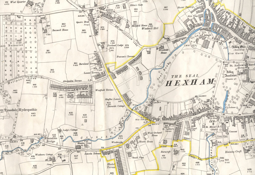
1st edition About 1860
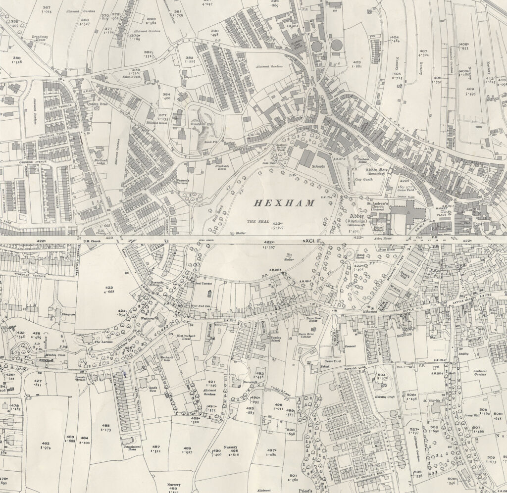
2nd edition Late 1890s
3rd edition About 1920
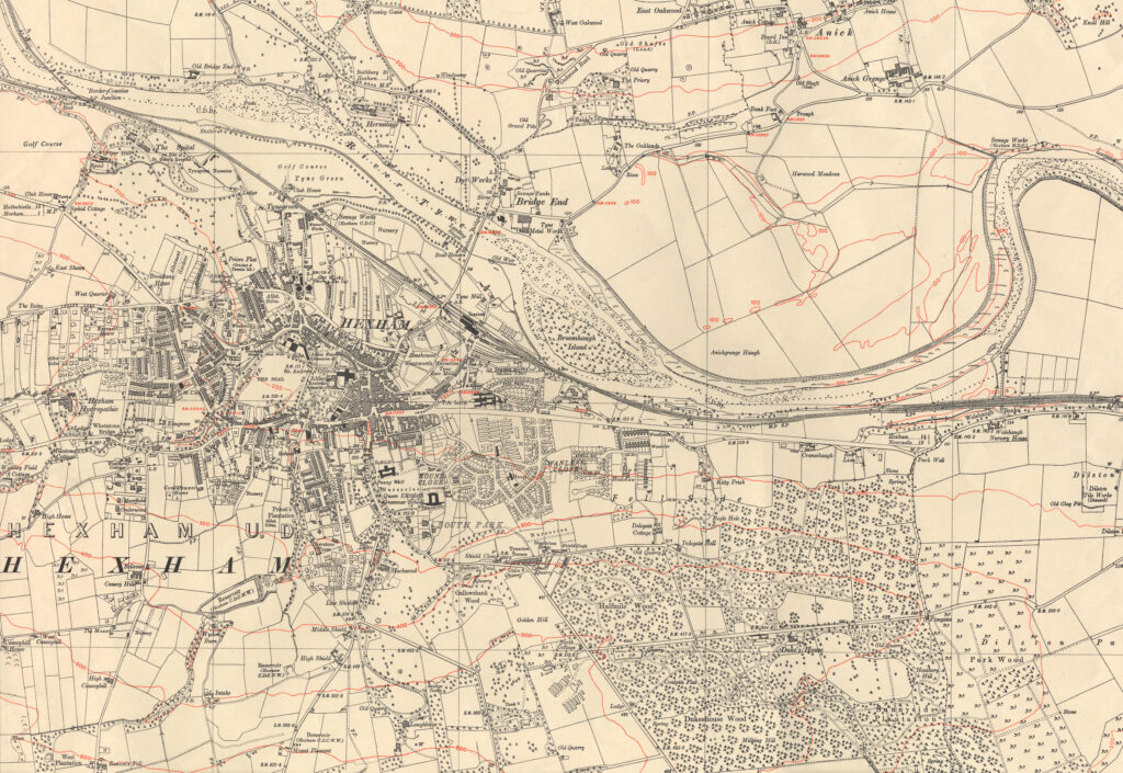
4th (Provisional) edition Pre-WW2.
1st Edition
2nd Edition
3rd Edition
4th Edition
Give it a go
Activity 1 – Identify Hexham House on the 1st edition map. Locate Hexham House on subsequent maps. Are there any changes to the shape of the property over time?
Activity 2 – Identify the edition that Maiden Cross is first shown on.
Scales of Historical Maps
The different scales of historical map produced are:
1 inch to 1 mile
6 inch to 1 mile
25 inch to 1 mile
10 feet to 1 mile (produced for larger settlements)
Probably the most useful scale for the property historian is the 25 inch to 1 mile scale map. The scale allows the user to distinguish the physical shape of a building.
The first edition 25 inch to 1 mile maps were accompanied by Books of Reference (sometimes called Area Books). Not all of the books survive locally but Northumberland Archives does hold some of these books. The map is keyed and you should locate the key number that relates to the property that you are researching in the book of reference. This will provide you with additional information about the property, in particular about the acreage and the state of cultivation.
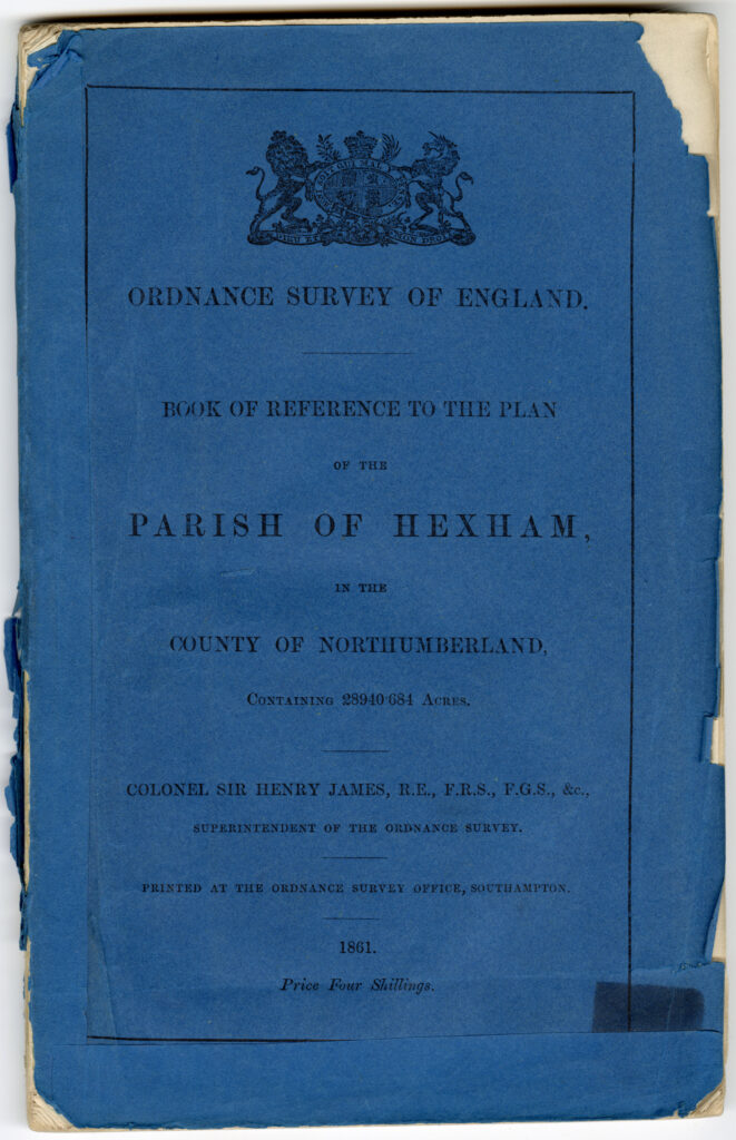
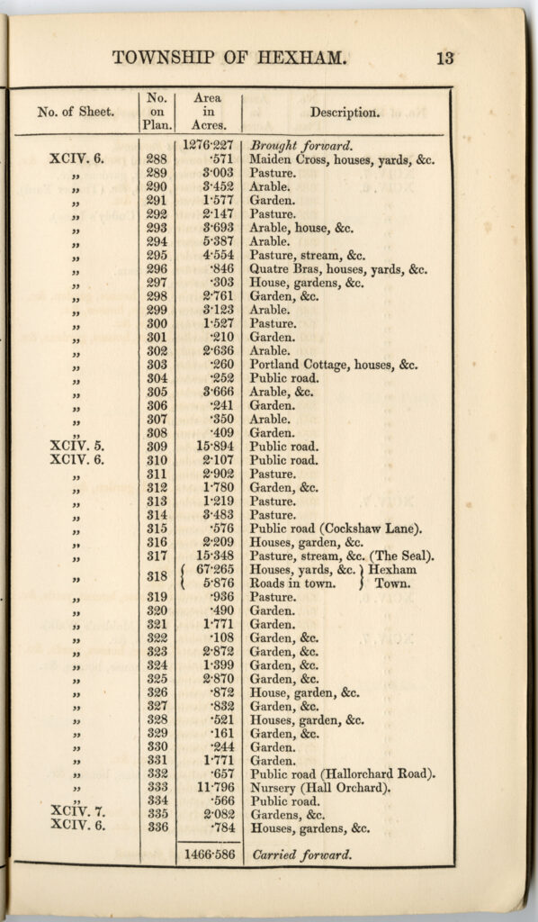
Hard copies of most editions of Northumberland Ordnance Survey maps can be viewed in our searchroom at Woodhorn. Digital copies of many Ordnance Survey maps for places in Northumberland, including Hexham, can be found on the website of The National Library of Scotland (National Library of Scotland – Map Images (nls.uk)). Our Northumberland Communities website includes digital copies of sections of some historical Ordnance Survey mapping for Hexham:
Give it a go
Activity 1 – Identify plot 326 on the 1st edition Ordinance Survey Map.
Activity 2 – Use the book of references to find the details of plot 326.
Pre-Ordnance Survey Maps
Prior to the establishment of the Ordnance Survey Board, local surveyors, often with the backing of wealthy patrons, produced detailed county maps to reasonable scales. These maps are useful in locating names of former settlements or even local properties that no longer exist. Some of these maps include larger scale maps of the larger settlements. Whilst they do show some individual properties these tend to be more substantial properties, sometimes the homes of families that subscribed to the production of the map. The quality of these maps can be variable. Sometimes errors were copied from an earlier map by the surveyor of a new map.
Digital copies of sections of the following maps for the Hexham area can be found on Northumberland Archives’ Northumberland Communities website:
Speed’s map of Northumberland 1610
Armstrong’s Map of Northumberland 1769
Wood’s Plan
John Wood, a land surveyor from Edinburgh, produced a series of high quality plans of various towns across Great Britain in the first part of the 19th century. These included a plan of Hexham produced in 1826. The plan is very detailed showing individual properties with the names of some owners/occupiers recorded. A digital copy of the plan can be found on the Northumberland Communities website – Hexham, Woods Town Map (northumberland.gov.uk).
The original plan can be viewed in our searchroom at Woodhorn. The reference number for the plan is NRO 00324/G/5.
Tithe Map
The Tithe Commutation Act of 1836 converted the payment of tithes (a tenth of either the produce of the land, stock of the profits of labour) due to the rector or vicar of a parish to an annual rent based on the value of corn. As a result of the Act a large scale map was drawn up for the majority of townships in England & Wales together with an accompanying schedule or apportionment. The schedule listed landowners and occupiers and gave details of the acreage of properties and details of the tithe payable.
Tithe maps are an important source for property historians. The scale of the map allows the identification of individual properties. Each property on the map is keyed and you should look for the key number of the property on the accompanying schedule. The information on the apportionment indicates whether the property is owner occupied or tenanted. Where a property was tenanted a note should be made of the landowner. You should then check Northumberland Archives catalogue to see if any records of the landowning family exist [link here to section of estate properties section].
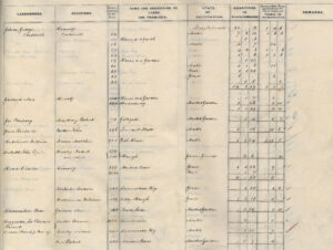
The tithe map for Hexham (ref no DT 241L) was drawn up in 1844. A section of the plan has been digitised and is available to view on the Northumberland Communities website – Tithe Award, Plan (northumberland.gov.uk) . Unusually, the names of some of the occupants are recorded on the map. A sample section of the apportionment is also available on the Northumberland Communities website – Tithe Award, Text (northumberland.gov.uk). MW – just hyperlinks?
This shows the detail provided on the apportionment. The full tithe plan can be viewed in the searchroom at Woodhorn.
Give it a go
Activity 1 – Identify plot 879 on the tithe map. Which name is recorded on the property on the map?
Activity 2 – Use the apportionment to find the details of plot 879.
Answer goes here.
Answer 1
Answer 2
Answer 3
1910 Land Valuation
The Finance Act of 1910 imposed a tax on profits derived from the sale of property in England & Wales if the profit arose from the introduction of amenities provided at public expense. To allow the introduction of the tax a survey of properties was undertaken and the survey papers are a useful source for property historians.
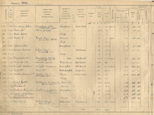
The first source to look at is the maps. These are marked up versions of the 2nd edition 25 inch to 1 mile Ordnance Survey map. The Northumberland Communities website includes a digitised version of a section of one of the maps for the centre of Hexham – Land Valuation Map (northumberland.gov.uk). The same website includes a sample page from one of the accompanying books of reference – Land Valuation Book (northumberland.gov.uk). The first step is to locate the property on the map, make a note of the key number and then find the key number in the book of reference. This will record the owner and occupier of the property, a description of the property, an address, acreage and information about the valuation. Again, information about ownership is useful and may lead you to look at estate records [link here to section of estate properties section].
Give it a go
Activity 1 – Identify the property with the key number 787 on the map.
Activity 2 – Use the book of reference to find the details of the occupier and description of the property for the property with the key number 787.
Field books
The National Archives holds field books, more detailed information drawn up during the 1910 Finance Act survey. These are not available online but can be viewed at The National Archives in Kew [link to National Archives website – The National Archives].
This guide Land use, value and ownership: Valuation Office Survey 1910-1915 – The National Archives sets out details of the 1910 Finance Act records held by The National Archives including information about the field books, a sample image of a field book and information about how to order digital copies.
Goad’s Fire Insurance Plans
Goad’s Fire Insurance plans were drawn up to provide information to assess fire insurance claims. They generally show the function of the building, for example, a particular type of shop, and the names of the individuals or companies based there. Charles Goad first produced fire insurance plans in the late 19th century. The plans went through repeated revisions until the late 20th century. Northumberland Archives holds Goad’s plans for Hexham for 1975, 1990, 1994 and 1996 (refno: NRO 05977/4). These can be viewed in our searchroom at Woodhorn. Hexham Library (insert link to Hexham Library – Full Display – Record 1 of 1 | Northumberland Libraries (spydus.co.uk)) also holds copies of some of Goad’s plans for Hexham.
Other Plans
Northumberland Archives holds many other maps and plans of Hexham. Some of these are held within estate collections. If the property that you are researching was built or substantially changed from 1885 it may be possible to locate a Local Authority building plan (see the Planning Records section for more information). It is always a good idea to make a general catalogue search on the name of the property, the name of the street, the names of previous owners or tenants as well as a general search for Hexham. Any items identified in the catalogue can be viewed in our searchroom at Woodhorn.
Reading List
W. Foot Maps For Family History (PRO 1994)
R. Kain & H. Prince Tithe Surveys For Historians (Phillimore 2000)
Websites
National Library of Scotland – digital maps – National Library of Scotland – Map Images (nls.uk)
Northumberland Communities – Northumberland Communities
The National Archives – The National Archives

