|
British Coal Opencast Aerial Photographs
1966 - 1971
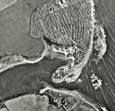
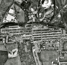
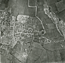
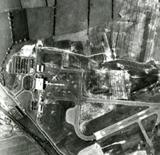
When Google Maps was launched on the 8th February 2005 it transformed the way we see the world. Prior to this, Aerial Photography was the only way to see the land from directly above. The National Coal Board Opencast Division photographed the South East of Northumberland from the late 1960s looking for geological features which might indicate large areas of coal. However, they inadvertently created a vast photographic record revealing incredible detail. Each photograph was taken at an altitude of 10,000 feet, placed next to or overlaid on a 1:10,000 Ordnance Survey map they are exactly to scale. The photographs are quite simply, stunning!
These four images illustrate the level of detail contained within each photograph and using an image overlay from Google Maps we have shown the changes which have taken place. Of particular note is the coastal erosion of Sandy Bay, and the disappearance of Ashington Colliery.
Top Left - Sandy Bay - NRO 4553/1/6
Top Right - Ashington Town Centre and Pit - NRO 4553/1/6
Bottom Left - Cramlington - NRO 4553/1/8
Bottom Right - Airport - NRO 4553/1/8
|